 ENEA Antarctic Data Center
Atmospheric conditions
Type of resources
Topics
INSPIRE themes
Keywords
Contact for the resource
Provided by
Formats
Representation types
Update frequencies
status
Scale
-
This research addressed a feasibility study for a remote monitoring system based on acoustic tomography to be used in antarctic regions. The analysis of data collected during PNRA oceanographic campaigns provided the environmental scenarios and the oceanographic processes to be successfully monitored by means of acoustic tomography and the appropriate information and data to initialize the tomographic processor. The case studies regarded High Salinity Shelf Water formation process in Terra Nova Bay polynya. The simplified but realistic environmental scenario considered a 1000 m deep area with a flat bottom. The dense water formation area was defined by a strong vertical salinity gradient in the surface, while in the areas outside, temperature and salinity were considered constant in depth leading to an almost linear increasing sound speed profile. At this stage of study, the possible presence of ice layer covering the area is not expected to have any significant effect on the propagation prediction, so it was not considered. Simulations were carried out with a beam model (Bellhop) which is well suited for active sonar modelling and ocean acoustic tomography in a range dependent environment. Each simulation involves the use of an acoustic source and a receiving station (tomographic pair) consisting of a vertical array of hydrophones. By measuring the travel time relative to different scenarios, the analysis aimed at understanding if the detection of the oceanographic phenomenon is feasible. In particular, the study aimed at determining the best compromise between acoustic frequencies, sensors number and geometrical configuration, in order to achieve the desired spatial-temporal resolution useful to detect the presence of dense water masses. An acoustic system configuration consisting of an acoustic source transmitting a pulse with a carrier frequency of 10 kHz, and of a receiving array made of 6 hydrophones resulted to be appropriate, while the minimum size of detectable Dense Water Mass is 0.5 km. In particular, the conducted sensitivity study evidences that the measure of travel time of acoustic rays can be successfully exploited to detect the presence of a dense water mass in a polynya area Acoustic tomography thus provides “images” of wide areas in the inner ocean for long periods and with an high temporal resolution; in addition it permits to reconstruct the sound speed field even in the upper layers where direct measurements cannot be performed as instruments are at risk of damage. It can then be consider a powerful mean of observation that well integrates conventional in situ measurements. Preliminar investigation on the applicability of this methodology in Terranova Bay polynya demonstrated that it is able to resolve the vertical structure of water column with a good precision.
-
Exploratory study for the development of technologies required for biological, geological and physical-chemical entry and sampling in subglacial lakes under high contamination-free conditions. The proposed activity is part of an international initiative, promoted and sponsored by SCAR and COMNAP in which Italy is also represented. The scientific objective is the development of miniaturized technologies for the execution of chemical-physical-biological measurements and of remoting technologies for the transport of instrumentation to the operational site, possibly enabling "in situ" sampling and material recovery operations.
-
The UV spectral measurement at ground it’s a diffuse method to determine the stratospheric ozone content. The main objective of the project was the assembling of the UV filter radiometer (named F-RAD) for the measurements of the Sun global irradiance at the Mario Zucchelli Station (MZS), Terranova Bay, Antarctica. The main parts of the instruments are: the entrance radiation optical system, the filters selecting the wavelength of interest and the control system, hardware and software, governing all the measurement steps. The main requirements were: time resolution of one minute and spectral resolution less than 1 nm. The researchers of the project have been participated at two Antarctica campaign, the XXI campaign, 2005, and the XXV campaign, 2009. - XXI Campaign: the radiometer was tested in the Antarctica environment in order to check the reliability of the different components and the optical stability of the filters. - XXV Campaign: the radiometer F-RAD was definitively placed on the roof of one of the MZS building and connected with the Local Area Network of the base. the UV data were daily downloaded in Italy. The spectral UV data acquired with high time resolution, each wavelength was measured 1430 time per day and high spectral resolution, the filters have a FWHM of 0.5- 0.8 nm. F-RAD was placed in Antarctica in November 2009 and works properly, the different parameters are checked daily.
-
The project aims to determine the mass balance components in the Dome C drainage area and to study and monitor local glaciers in Victoria Land. The goal is to define the mass balance of the ice cap through the analysis of its altimetric variation with satellite systems and through the determination of the values of the positive (snow accumulation) and negative (flow of glaciers to the anchor line) components of the balance mass. Trought the study of the snow cores (collected as part of the ITASE project (XVII/XVIII expedition)), was determined the annual stratigraphy and evaluated the snow accumulation, the isotopic temperature and the chemical composition of the snow cores. Moreover analysis of geophysical data (GPR, GPS, RES, spectroradiometry) and remote sensing data were carried out for the study of the variability of snow accumulation, of the dynamics of the ice cap and of the flow of glaciers to the anchor line.
-
The project aims to estimate the current mass balance of glaciers and in particular of the Antarctic ice sheet by studying the space-time variations of the balance of snow accumulation through the integration of meteo-climatic and glaciological data. Analysis of weather-climatic and snow measurements collected by AWS stations (Dome C, C3, High Priestley, Talos Dome and a Nansen Ice Sheet) using sensors for measuring snow transport and measuring poles. Snow radar data collection of the Dumont d’Urville-Dome C traverse. Analysis of the chemical and isotopic composition of the collected snow samples. Analysis of satellite data to define the path of the Talos Dome-Dome C-Vostok-Dome B-Dome A crosspiece. High resolution chemical / isotopic analyzes (samples in trenches) for the study of post-depositional diffusion / re-emission processes that occur in the part of the snow closest to the surface. Study of the spatial variability of the snow accumulation at the TD site and along the ITASE traverse. Continuation of the analysis of the samples and geophysical data collected in the previous ITASE traverses.
-

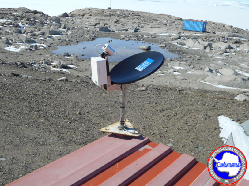
In the MAss LOst in wind fluX (MALOX) project the automatic weather station AWS Virginia purpose is to contribute to the monitoring of global climate change monitoring standard meteorological parameters. The AWS is located at Inexpressible Island (74°56’S 163°41’E) at --- m a.s.l., and has been installed on the ---. It acquired, every minute, all year round, the meteorological vaiables of wind velocity, wind direction, temperature, pressure and relative humidity.
-
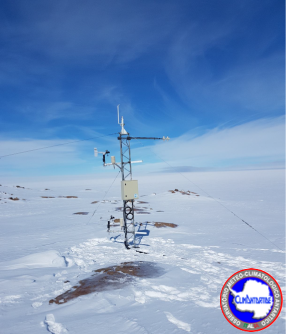
The aim of the MAss LOst in wind fluX (MALOX) project is to better understand the phenomenon of snow transport over a coastal area characterized by strong winds. The automatic weather station AWS Lucia purpose is to contribute to the monitoring of global climate change monitoring standard meteorological parameters. The AWS is located at Larsen Glacier, (74° 57′ 2″ S - 161° 46′ 19″ E) at 1350 m a.s.l., and has been installed the 25 january 2007. It acquires, every minute, all year round, the meteorological variables by two sensors for wind velocity and wind direction, two sensors for temperature (at 1 and 3 meters) and for relative humidity, and finally one for atmospheric pressure. Moreover, the AWS acquires further data using radiation sensor (longwave and shortwave), driftometer for the snow transport and height snow sensor.
-
The project aims to estimate the current mass balance of glaciers and in particular of the Antarctic ice sheet by studying the space-time variations of the balance of snow accumulation through the integration of meteo-climatic and glaciological data. Analysis of weather-climatic and snow measurements collected by AWS stations (Dome C, C3, High Priestley, Talos Dome and a Nansen Ice Sheet) using sensors for measuring snow transport and measuring poles. Snow radar data collection of the Dumont d’Urville-Dome C traverse. Analysis of the chemical and isotopic composition of the collected snow samples. Analysis of satellite data to define the path of the Talos Dome-Dome C-Vostok-Dome B-Dome A crosspiece. High resolution chemical / isotopic analyzes (samples in trenches) for the study of post-depositional diffusion / re-emission processes that occur in the part of the snow closest to the surface. Study of the spatial variability of the snow accumulation at the TD site and along the ITASE traverse. Continuation of the analysis of the samples and geophysical data collected in the previous ITASE traverses.
-

The project aims to carry out a climatological analysis of the dynamics and structure of the Antarctic polar stratospheric vortex over the last decade 1993-2003 and its relationship with the 'Ozone (O3) hole' phenomenon. In particular will be evaluated all the data from the ground by LIDAR, gained by balloon and by satellite, a high resolution transport model and a GCM model will be used for the climatic characterization of the dynamics of the vortex and its interactions with the polar troposphere and mid-latitudes, and finally a climatology of aerosols and PSCs will be analyzed during the polar winter.
-
Data of the precipitation fallen during the summer months (November-December-January) on four expeditions, 2015-16, 2016-17, 2017-18, and 2018-19, in the Terra Nova Bay area, were obtained using a vertically pointing radar, disdrometer and snow gauge. The vertical pointing METEK Micro Rain Radar 2 (MRR) was installed in MZS at the end of November 2015. It records Doppler velocity spectra every 10 s at 32 range gates. The radar gate spacing was set to 100 m allowing the profiler to sound heights ranging from 100 to 3100 m above the surface. The raw K-band power spectra, collected by the MRR, were processed applying the method proposed by Maahn and Kollias (2012) to correct for noise and aliasing effects, making them suitable for snow observation. A Thies CLIMA laser disdrometer (LPM), has been operational since December 2014.The disdrometer can simultaneously count and measure the size and fall velocity of hydrometeors. A Total Rain weighing Sensor (TRwS) manufactured by MPS system was installed during the december 2018 - January 2019 campaign within the YOPP observing period. The TRwS is a total rain/snowfall weighing gauge with an orifice area of 400 cm2, a depth accuracy of 0.01 mm of w.e. and a one -minute sampling time resolution (Savina and others, 2012). The TRwS was protected by an alter shield in order to minimize wind effect over the accumulation inside the instrumentation.